Asteroid Hit North Sea: The Silverpit Crater Discovery & 2025 Proof
Eighty miles off the Yorkshire coast, a massive geological anomaly sits hidden beneath the waves. For over two decades, the Silverpit structure sparked intense arguments among scientists. Some believed it was just a natural seabed collapse, while others argued something much larger was responsible. Now, a definitive 2025 study has finally provided the proof.
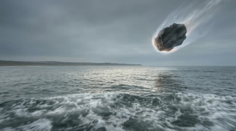
Yes, an asteroid hit the North Sea during the Middle Eocene epoch, between 43 and 46 million years ago. A 160-metre-wide asteroid struck 80 miles off the modern Yorkshire coast, creating the 3-kilometre-wide Silverpit crater and generating a colossal tsunami over 100 metres high.
Key Takeaways
- Location: The crater sits 80 miles off Yorkshire, exactly 700 metres below the modern seabed.
- Size: A 160-metre asteroid carved out a central crater 3 kilometres wide.
- Age: The strike happened 43 to 46 million years ago during the Middle Eocene epoch.
- Impact: The collision triggered a colossal tsunami measuring over 100 metres high.
- Proof: Scientists confirmed the impact in 2025 using shocked quartz from local oil well samples.
Quick Start: The Silverpit Impact at a Glance
Need the basic facts quickly? Here is a rapid summary of the Silverpit strike:
- What caused it: A hypervelocity asteroid striking the shallow prehistoric ocean.
- When it happened: Middle Eocene epoch (43 to 46 million years ago).
- Common mistake: Do not confuse the Silverpit impact with the dinosaur-killing Chicxulub event. Silverpit occurred millions of years later and did not cause a global extinction.
- The visible scars: A 20-kilometre-wide zone of circular faults surrounds the 3-kilometre main crater.
The 20-Year Debate: From Seabed Collapse to Asteroid Strike
Scientists first discovered the Silverpit structure in 2002 using seismic imaging. Its circular shape immediately divided the scientific community. Many experts refused to believe an asteroid hit the North Sea. Instead, they argued the shape came from salt withdrawal or a simple seabed collapse.
The argument grew so fierce that in 2009, experts held a formal vote. An overwhelming 80-20 majority voted that Silverpit was not an impact crater.
However, supporters of the asteroid theory kept looking for evidence. As Professor Gareth Collins of Imperial College London noted, “I always thought that the impact hypothesis was the simplest explanation… It is very rewarding to have finally found the silver bullet.”
To resolve the mystery, researchers needed physical proof from the crater floor, which sits deep beneath the ocean. Drilling a new hole just for research would cost millions of pounds. Researchers studying the history of geological debates knew they needed a more creative solution to gather physical evidence.
How Legacy Oil Wells Solved the Mystery
The North Sea already hosts extensive energy infrastructure. Researchers realised they did not need to drill a new hole at all.
Instead, they looked at legacy rock samples. The definitive proof came from an old 1980s oil well named well 43/25-1. This well was drilled near the crater long before anyone knew the geological structure existed.
Pro Tip: Researchers can leverage legacy oil and gas drill cores for modern geological research. They are invaluable for deep-sea sampling without incurring new drilling costs.
Typical scenario example: An offshore energy company conducting carbon capture surveys maps the seabed using 3D seismic data. They spot concentric fault rings. Geologists then cross-reference these shapes with legacy drill core samples to confirm an ancient impact site, completely avoiding the cost of new exploratory wells.
The “Silver Bullet”: How We Know an Asteroid Hit the North Sea
In 2025, a landmark study backed by UK government-funded environmental studies put the debate to rest. Scientists analysed the old oil well samples and found rare shocked quartz and feldspar crystals.
These microscopic crystals possess a unique fabric. Extreme pressures from hypervelocity impacts alter their atomic crystalline structures. Earthly processes like volcanoes simply cannot create this specific pattern, known as planar deformation features (PDFs).
Dr Uisdean Nicholson of Heriot-Watt University explained the breakthrough. “New seismic imaging has given us an unprecedented look at the crater… We were exceptionally lucky to find these crystals.”
Pro Tip: Look for planar deformation features in quartz when attempting to prove hypervelocity impacts. It is the definitive evidence required by modern geology.
Typical scenario example: A UK university geology department uses the Silverpit data as a primary teaching model. By studying the North Sea quartz samples under microscopes, students learn exactly how hypervelocity impacts differ from terrestrial volcanic activity.
Hypervelocity Impact Verification Checklist:
- Identify a circular morphology and central uplift using 3D seismic imaging.
- Locate concentric fault rings surrounding the centre.
- Rule out terrestrial causes like salt withdrawal or magma chamber deflation.
- Extract core samples from the exact depth of the crater floor.
- Conduct microscopic analysis specifically for shocked quartz and planar deformation features.
The Catastrophic Impact: 100-Metre Tsunamis Off Ancient Yorkshire
Researchers at Imperial College London provided numerical modelling to understand the physical scale of the event. Their results paint a terrifying picture of the prehistoric Yorkshire coast.
The Sequence of the Strike:
- The 160-metre impactor struck the shallow prehistoric sea at a low angle from the west.
- The collision instantly vaporised rock and water, violently ejecting a 1.5-kilometre-high curtain of material into the atmosphere.
- This massive water column quickly collapsed, generating a tsunami over 100 metres high that radiated across the UK continental shelf.
- The deep seabed rebounded from the extreme pressure, forming the central uplift and a 20-kilometre-wide zone of circular faults.
Pro Tip: When modelling ancient tsunamis, always factor in the initial water curtain displacement. Silverpit’s 1.5-kilometre splash directly correlated to the height of its massive 100-metre tsunami wave.
Summary: The Evidence and the Energy
- Deep-sea oil well samples contained shocked quartz, proving a high-speed asteroid impact.
- The initial strike ejected a water curtain 1.5 kilometres high.
- The resulting tsunami wave exceeded 100 metres in height.
- Imperial College London modelling confirmed the massive kinetic scale of the collision.
Comparing Silverpit to Other Geological Events
Silverpit is incredibly rare. It is one of Earth’s exceptionally preserved marine impact structures. Globally, scientists have identified only about 33 confirmed impact sites beneath the ocean.
Pro Tip: If studying offshore Yorkshire geology, map the entire 20-kilometre concentric fault zone rather than just the 3-kilometre central crater. This helps you understand the full kinetic scale of the impact.
| Feature | Silverpit Crater (North Sea) | Chicxulub Crater (Mexico) | Volcanic Seabed Collapse |
| Cause | Asteroid Impact | Asteroid Impact | Magma Chamber Deflation |
| Era | Middle Eocene (43-46 million years ago) | Cretaceous-Paleogene (66 million years ago) | Various |
| Key Evidence | Shocked Quartz / Planar Deformation Features | Iridium Anomaly / Shocked Quartz | Igneous Rock / Lack of Shocked Minerals |
| Extinction Link | None | Non-Avian Dinosaurs | Localised Marine Life |
Dating the Crater: The Middle Eocene Epoch
Because Silverpit is an impact crater, some people immediately associate it with the dinosaur extinction. However, earlier studies of the sediment inside the crater ruled out any link to the K-T boundary dinosaur event.
Instead, the impact is firmly dated to the Middle Eocene epoch. This places the collision between 43 and 46 million years ago. Dr Tom Dunkley Jones of the University of Birmingham noted that studying the fossil remains of microscopic plankton showed that this catastrophic event happened in a narrow time window.
Pro Tip: You must account for post-impact sedimentation when dating marine craters. Silverpit’s exceptional preservation is directly due to its immediate burial in a marine environment.
Marine Crater Dating Decision Tree:
-
Are post-impact sediment layers preserved?
-
Yes: Analyse biostratigraphy (microfossil plankton) to find the narrow time window.
-
No: You cannot rely on biostratigraphy. You must use alternative radiometric dating of impact melt rocks if they are present.
-
End Summary
The combination of 3D seismic imaging and legacy oil well samples finally put the 20-year Silverpit debate to rest. The 2025 study definitively proves that a massive asteroid struck the ancient North Sea. This hypervelocity impact dramatically shaped the geological history of the UK continental shelf and generated a tsunami that devastated the prehistoric coastline.
Next Steps:
- Review the official 2025 findings published by Heriot-Watt University and the Natural Environment Research Council.
- Explore 3D seismic mapping principles to understand how offshore marine features are discovered.
- Visit Yorkshire-based natural history museums to learn more about the region’s ancient geological past.
FAQs
Exactly where is the Silverpit crater located?
It is located in the southern North Sea, approximately 80 miles off the coast of Yorkshire, sitting 700 metres below the current seabed.
Did the North Sea asteroid kill the dinosaurs?
No. The North Sea impact occurred during the Middle Eocene epoch, millions of years after the non-avian dinosaurs went extinct.
How big was the asteroid that hit the North Sea?
The impacting asteroid was approximately 160 metres wide.
What is “shocked quartz” and why does it matter?
Shocked quartz features microscopic changes to its crystalline structure caused by extreme pressure. It proves an area experienced a hypervelocity impact rather than normal volcanic activity.
How high was the tsunami caused by the Silverpit impact?
The collision generated a massive tsunami that measured over 100 metres high.
Why did geologists argue about the crater for 20 years?
Without physical rock samples, scientists debated whether the crater was formed by an asteroid, salt movement, or a natural seabed collapse.
Can you visit the Silverpit crater today?
No. It is fully submerged in the North Sea and buried under 700 metres of thick ocean sediment.